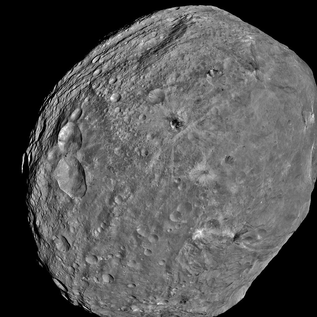
 Vesta Image from 5,200 kilometers Image Credit: NASA / JPL-Caltech / UCLA / MPS / DLR / IDA |
| See also full rotation movie of Vesta.
The Dawn spacecraft has completed imaging of Vesta from an altitude of 5,200 kilometers and has begun spiraling down to an altitude of 2,700 kilometers for the first series of scientific observations. Chris Russell, Dawn’s principal investigator at UCLA, notes:
Below are additional images of Vesta from the 24 July collection. |
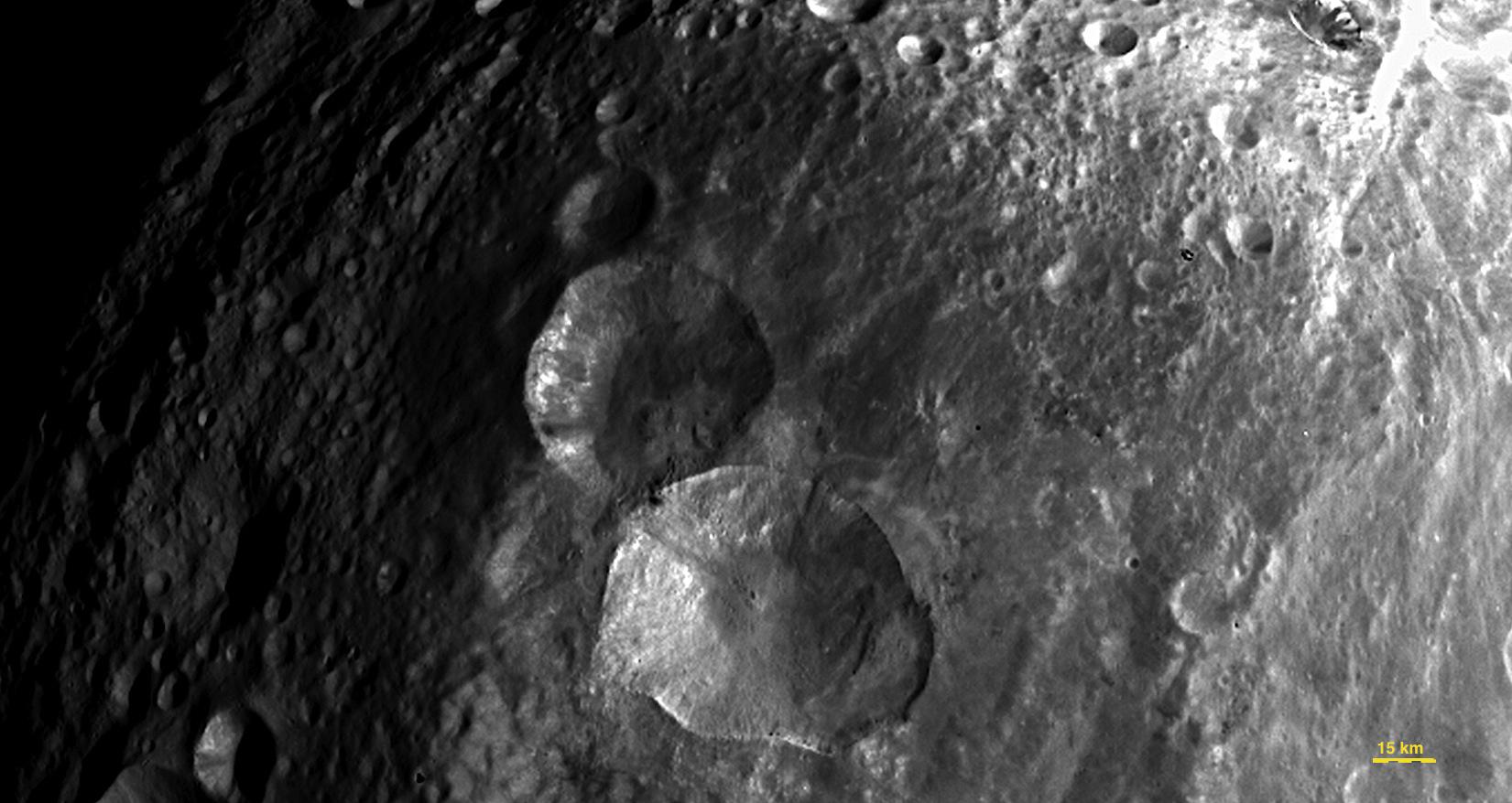 The “Snowman” on Vesta Image Credit: NASA / JPL-Caltech / UCLA / MPS / DLR / IDA |
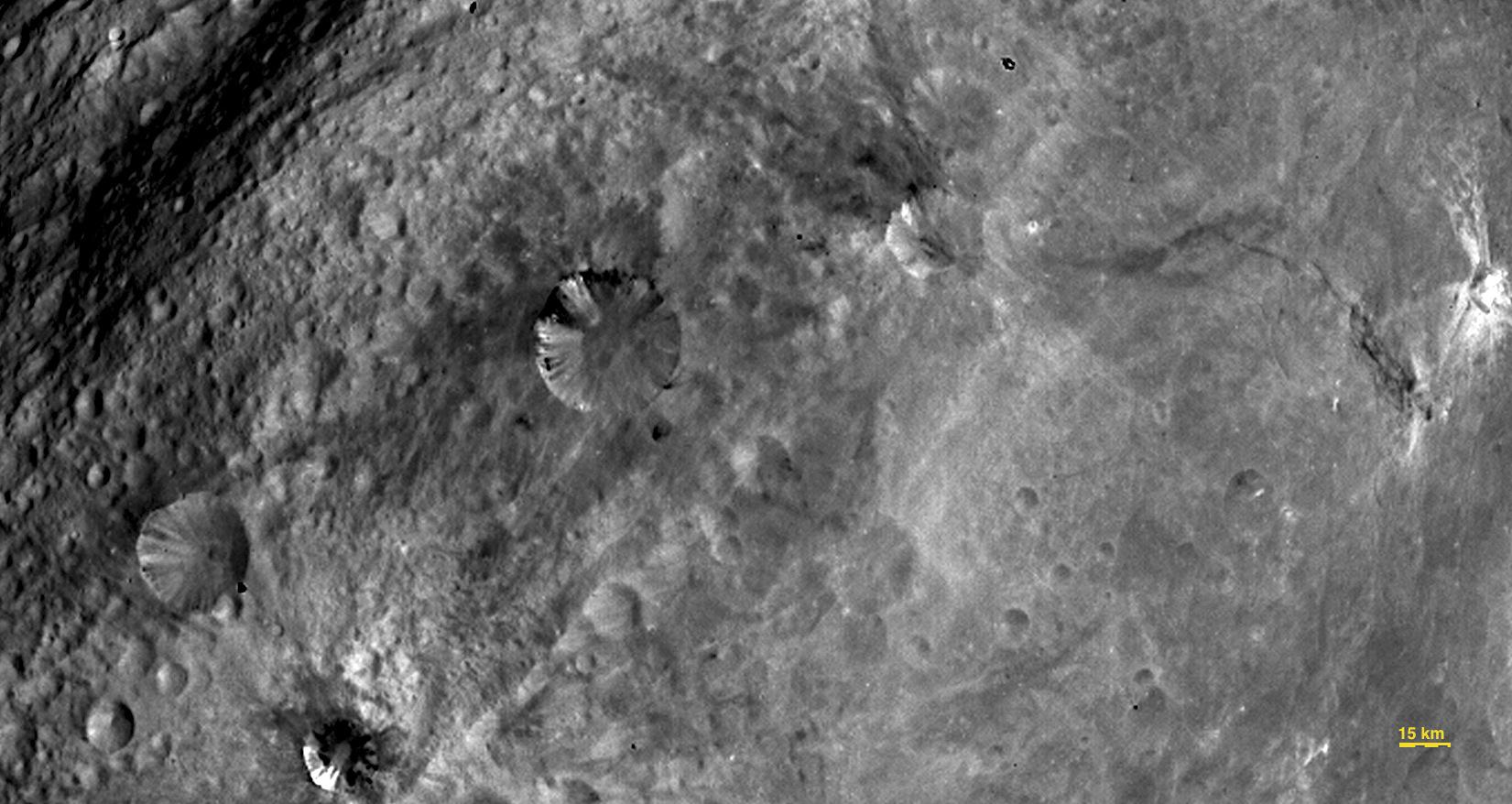 The Southern Hemisphere of Vesta with a multitude of craters Image Credit: NASA / JPL-Caltech / UCLA / MPS / DLR / IDA |


Book Review: Designing Farms in Space
Meyer’s academic textbook is loaded with numerous photographs, diagrams, charts, and graphs. There are chapters on subjects such as farm machines, animal and fungi production, plant and algae production, and space menus. The farming techniques outlined in the book can be applied to lunar, Martian, or rotating space settlements.


